 Besucher/Visitors
Counter
|
|
|
|
"Iceland 2010, part 6, the fifth week in Iceland, from Reykjavik to Vik" NOTE: Due to the duration of the trip and therefore volume of the diary I have split it up into several parts.
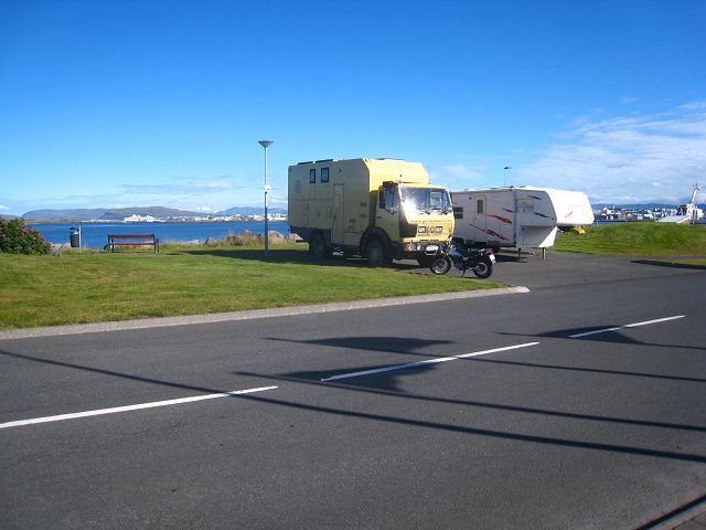
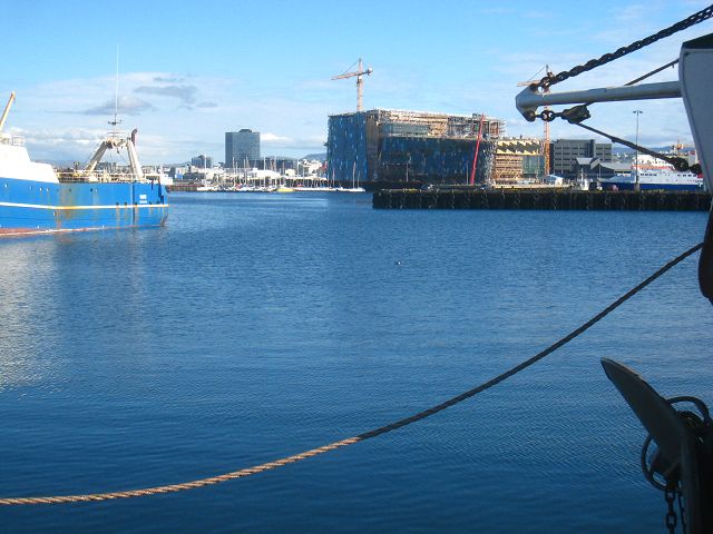
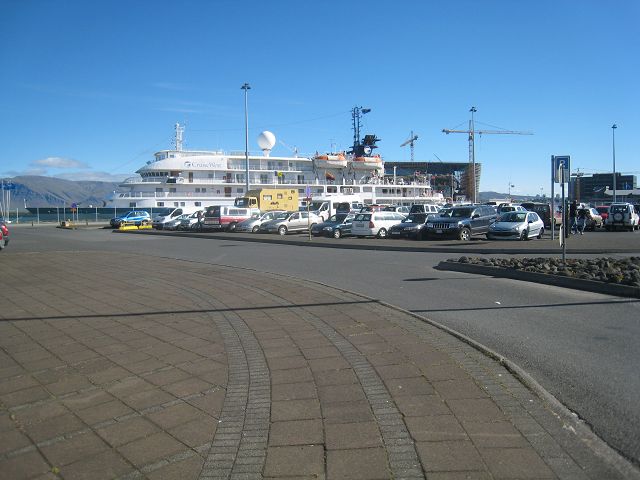
26.08.2010 Starting-km: 137.505, End-km 137.508, Distance 3 km (plus ~5 km on the motorcycle) The night wasn’t such a nightmare as predicted. The youngsters having their races here had finished by midnight. Because I didn’t needed further burn-outs and the city centre was quite a bit away I filled up diesel (130l, that’s 27l/100km) and parked now at the harbour in the street Eyjarslóð.
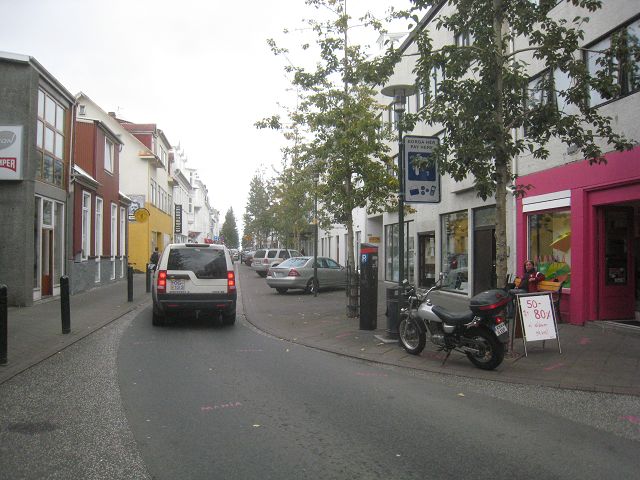
There I got the Suzuki out of the garage. Thursday was then typical tourist-entertainment – exploring Reykjavik.
With the Suzi it was really easy, driving, spotting something interesting – short stop – looking – taking a picture and off I went.
When I went in the evening by feet back to the city centre I heard a really good beat out of one of the big garages. Because the door was open I entered and I was allowed to join MIRI's exercising for their concert next day.
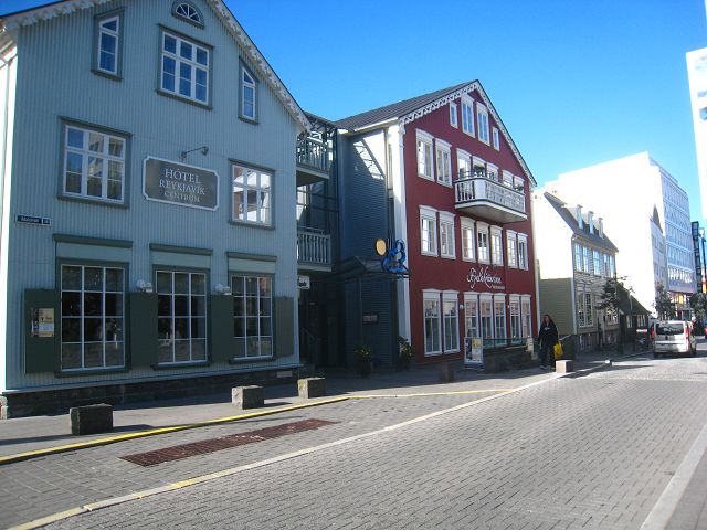
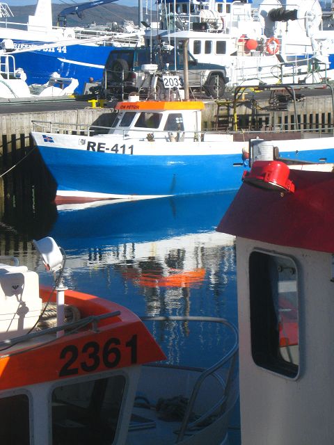
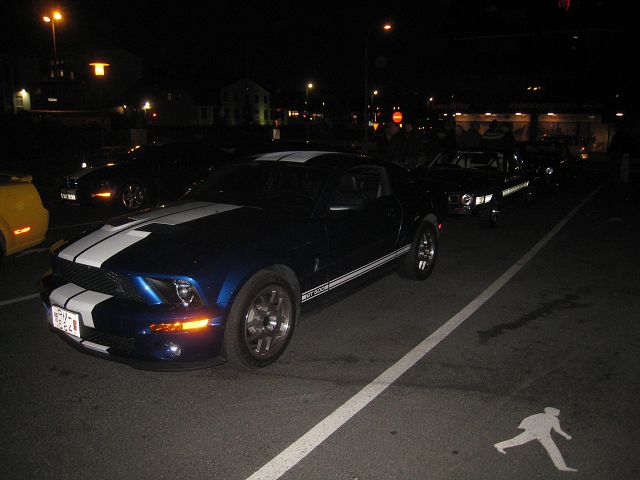
After I had dinner I walked the main shopping street Laugavegur where the locals were cruising: big motorcycles, all kind of historic American cars, a feast for the eyes and the ears!
That this night there were so many American cars must have been caused by a car-beauty-contest somewhere in Reykjavik which I unfortunately had missed.
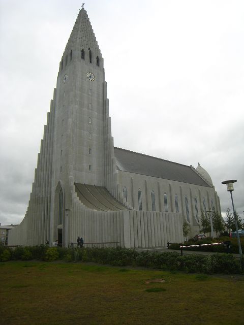
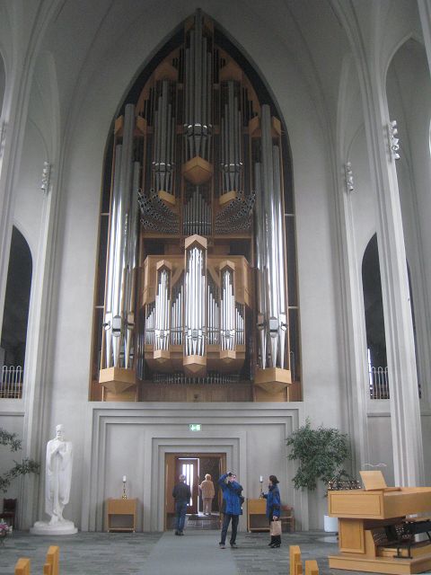
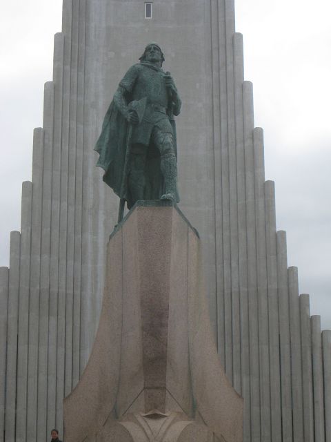
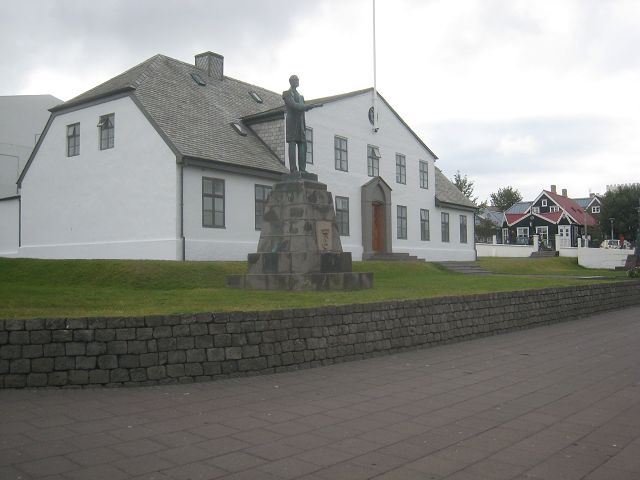
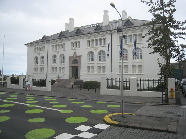
27.08.2010 Starting-km: 137.508, End-km 137.517, Distance 9 km (plus ~10 km on the motorcycle) Friday another tour, here the church,
from my POV a disappointing interior,
the column of Eric the Red,
the Parliament,
the culture house,
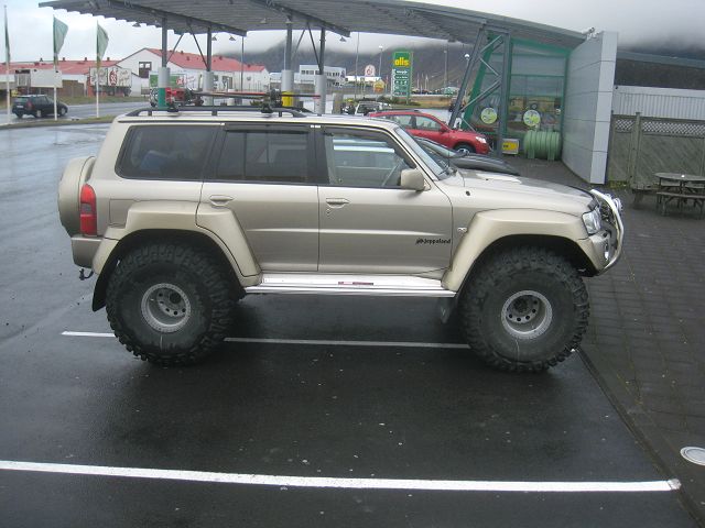
the Suzi in the street Laugavegur – but I have to admit that she didn’t raise that much interest when I cruised with her!!,
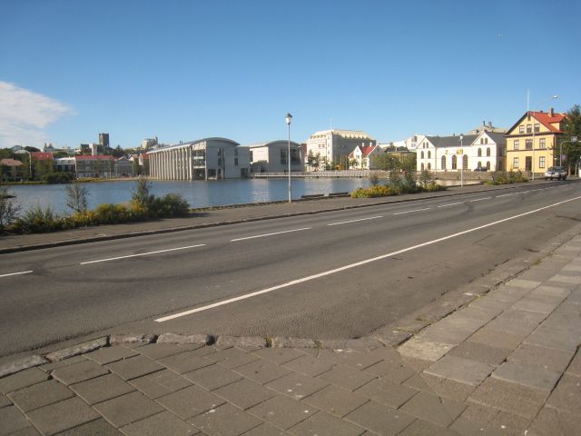
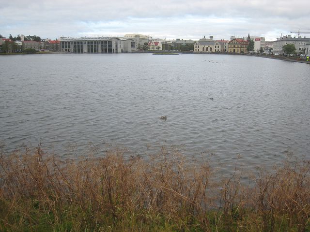
the lake Tjörnin with the town hall in the background,
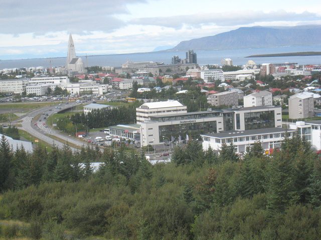
view from Perlan,
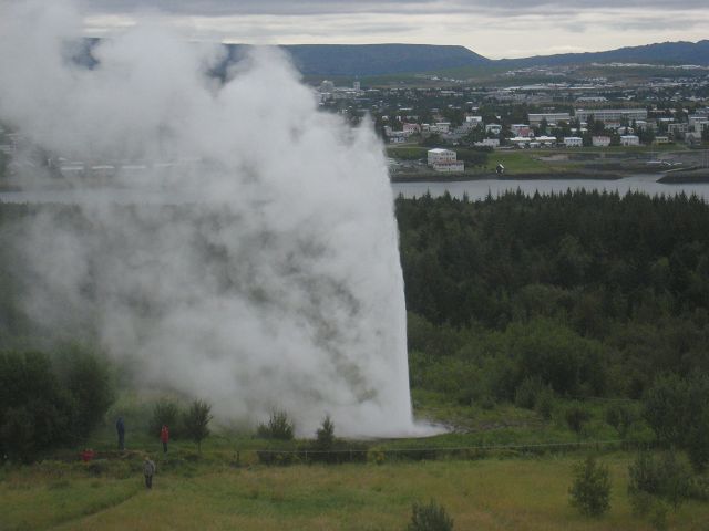
the artificial Gysir,
the relief in the town hall,
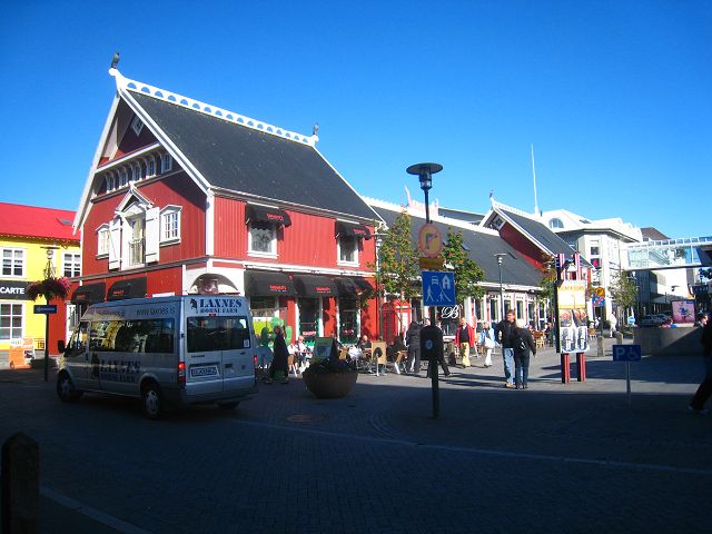
and here a nice place in the town centre.
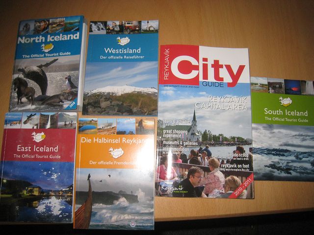
In the tourist office I completed my selection of the FOC guides from Iceland which I can only recommend.
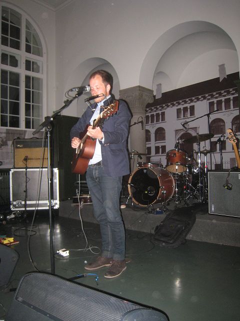
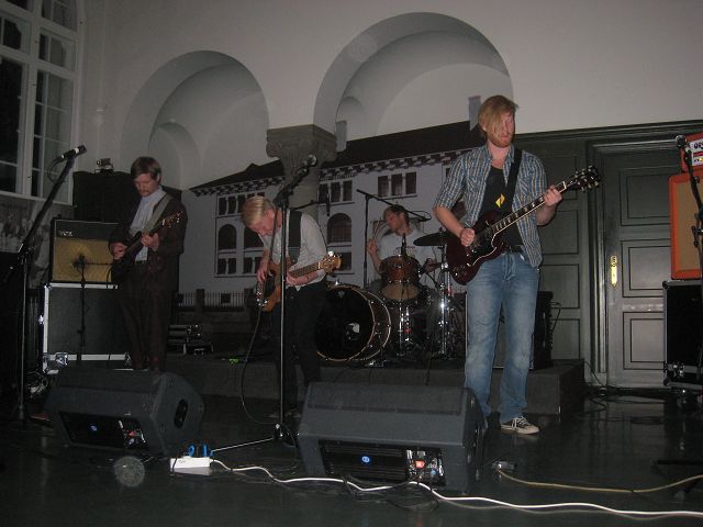
Because the distance to the city centre was still a bit long I moved again Big Foot after I had stored the Suzi in the garage, now directly at a parking place next to the wharf, the streets name is „Faxa Gata“. But before I finally rested their I wanted to cruise at least once Laugavegur-street with Big Foot – this time I had a lot more people gazing at me / Big Foot compared to my attempt with the Suzi! J I started the evening with the concert of the band MIRI who introduced their new CD, here one of the starting singers,
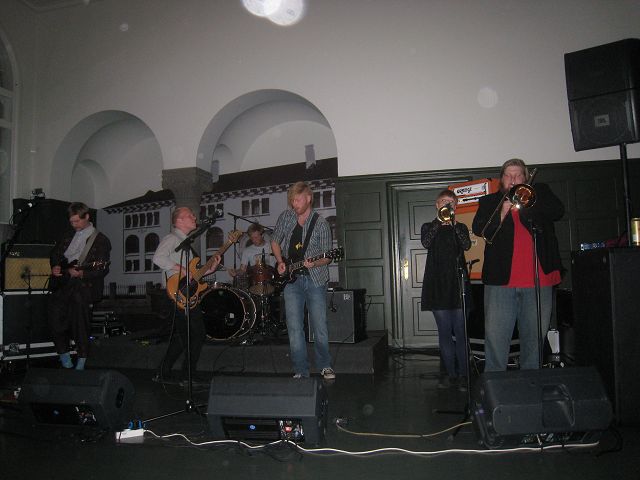
And here the guys from MIRI in „Action“.
The concert last till ~24:00h, I walked the Laugavegur street which was full of people, mainly young boys and girls and I visited 2 bars with live music as well. When I decided to go to bed at ~ 03:00h the people on the streets definitely didn’t wanted to finish that “early”. NOTE: Sven Strumann had warned me, not to stay overnight in Reykjavik outside of guarded campgrounds because the criminality because of junkies etc. is very high and a camper van is a welcome target for them. I didn’t had any bad experiences but wanted to mention it! And a further note for those who want to rent a 4x4 car in Iceland: You will be surprised about the costs but you have to respect that the season for that is 3, max. 4 months / year and after 2 years a spoiled American or a court contentious German would not accept any of these cars any longer. A good alternative for those who don’t mind an older car is http://www.cheapjeep.is/.
28.08.2010 Starting-km: 137.517, End-km 137.719, Distance 202 km Before I left on Saturday morning I made this photo of my “campground” before I headed southwest.
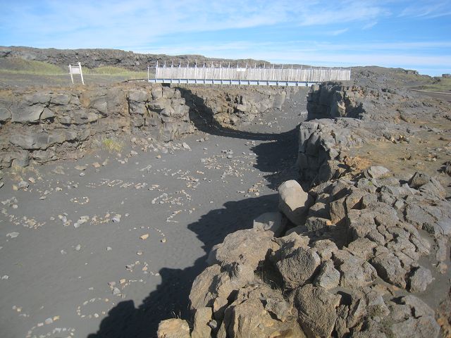
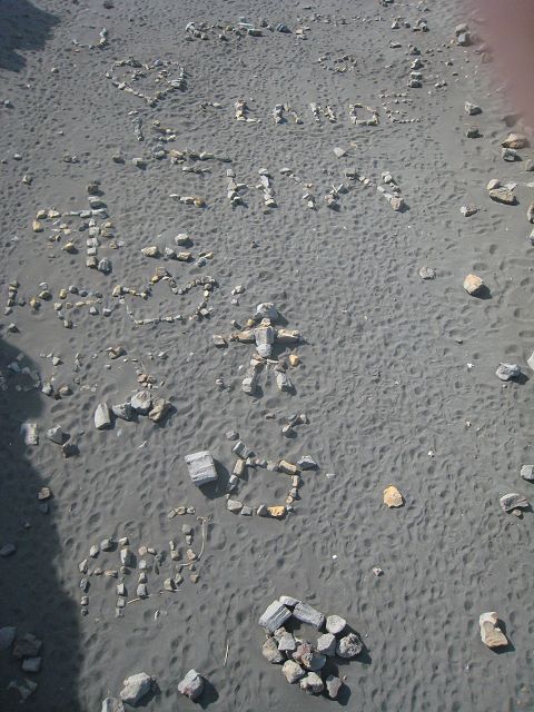
The first stop was at the bridge between the continents,
where people left “drawings” and notes made out of stones.
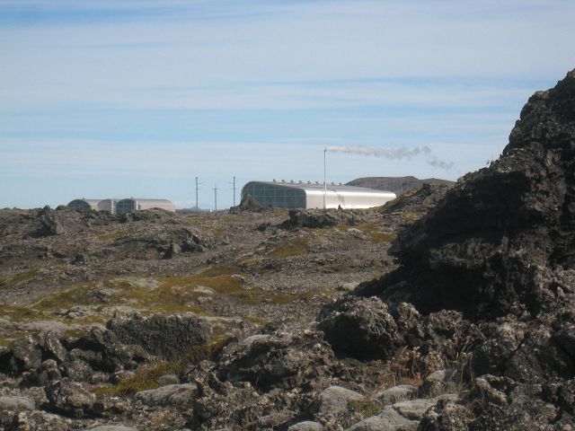
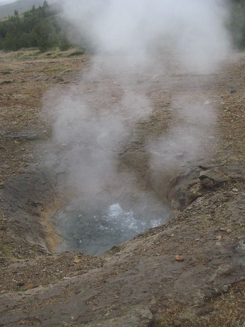
On the European continent at Reykjanes a geo-thermal power-plant,
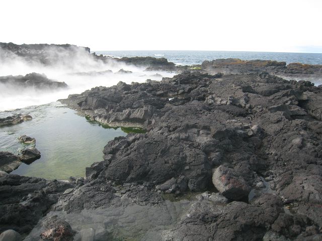
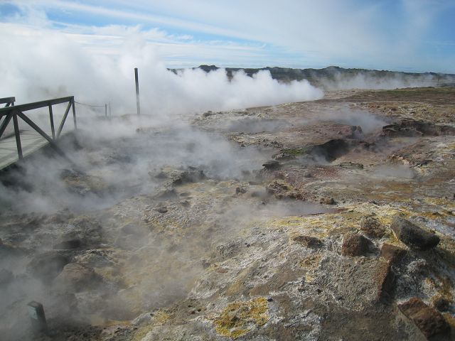
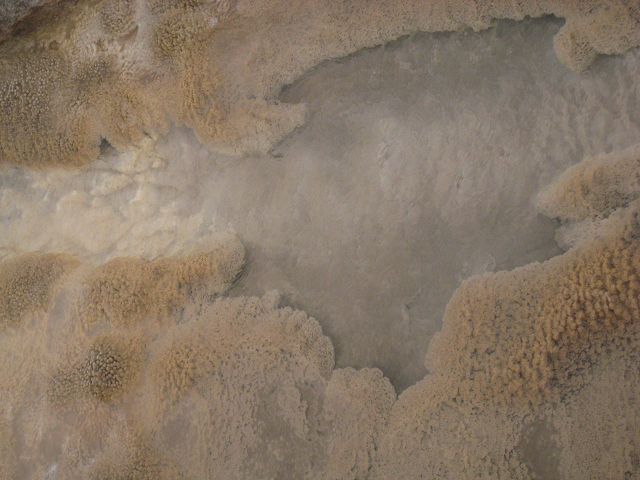
and spots where hot steam came out of the earth.
In the very western area is a light house with a nice view.
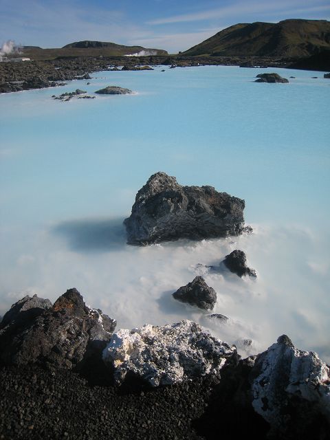
Without a visit to the Blue Lagoon a visit to Iceland isn’t complete I was told but 5.000 ISK (ca. EUR 35,-) was a little bit too much for my feeling for the spa.
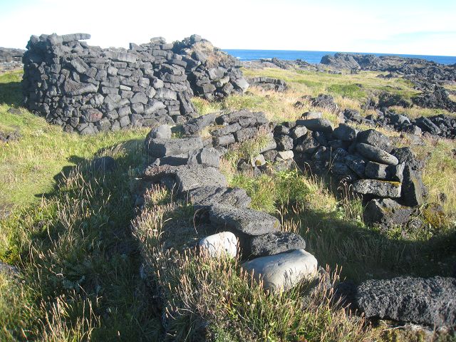
Selatangar was formerly a location till end of the 19th century where fishermen were living.
I went to bed at the sport yard of Eyrarbakki. (The next morning I realized that the big building in 300 m distance was the jail!)
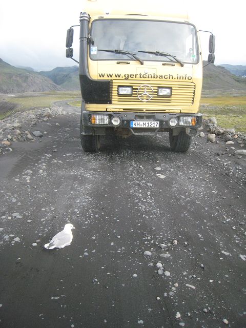
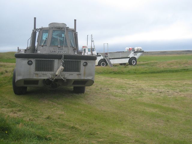
29.08.2010 Starting-km: 137.719, End-km 137.850, Distance131 km Unfortunately it was rainy this Sunday morning. On my way on the 35 at Selfoss I shot this photo of another Big Foot – I would recommend a ladder because of the entrance height!
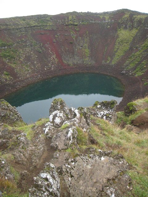
Further north-east I passed this typical volcano with a lake inside called Kerið.
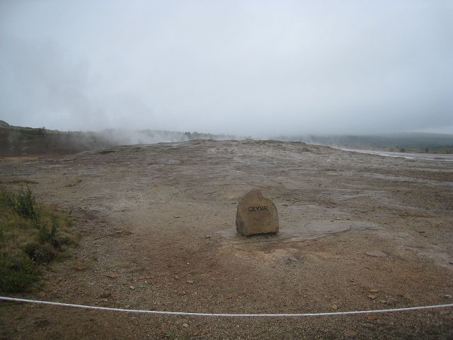
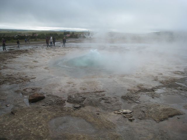
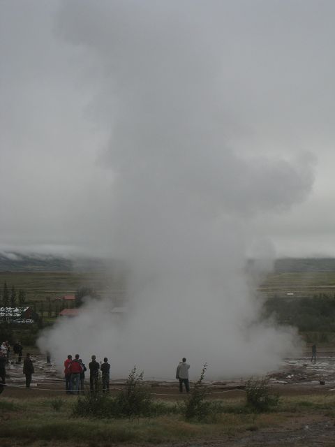
The next target is Geysir, which gave the name to the village and all other geysers.
The original Geysir is only active whilst earthquakes etc..
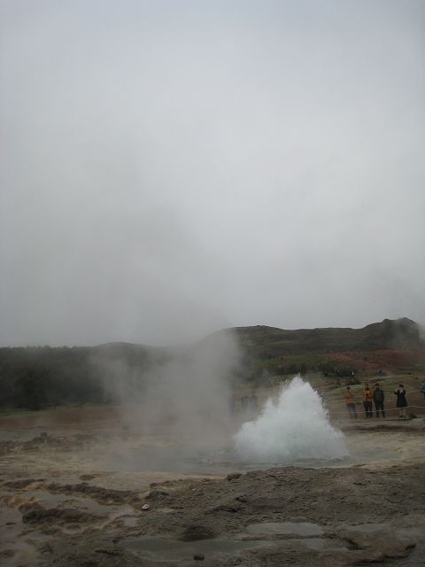
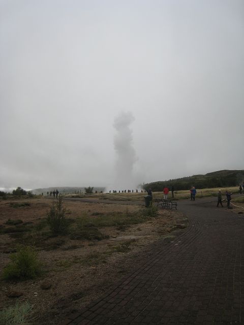
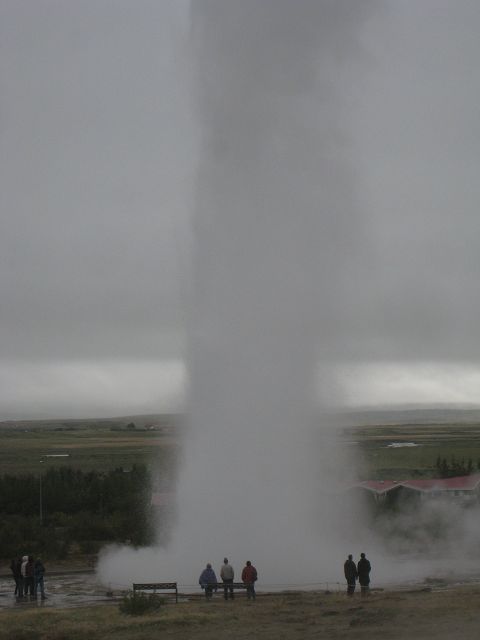
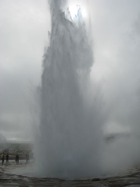
Strokkur ejects all 7 – 10 minutes a fountain up to 35 m high.
The longer the intervals the higher normally the fountain.
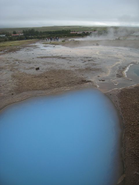
Here are lots of interesting places.
Finally I got a big shower when I was directly to the borderline and the wind had changed and really high fountain came out – head, overall, completely wet.
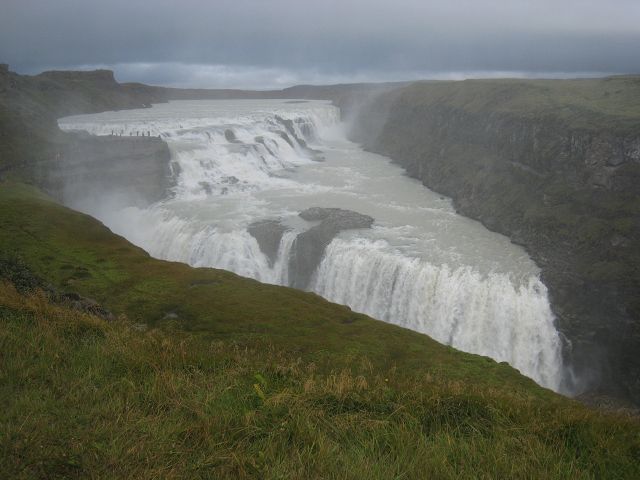
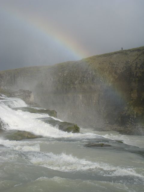
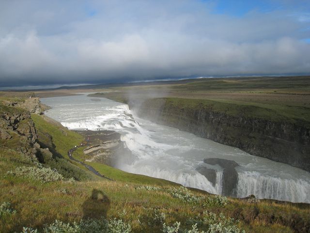
When I had dried myself I drove to Gullfoss waterfall.
I was lucky to have at least a little bit of sunshine and so I was able to get this photo with a rainbow.
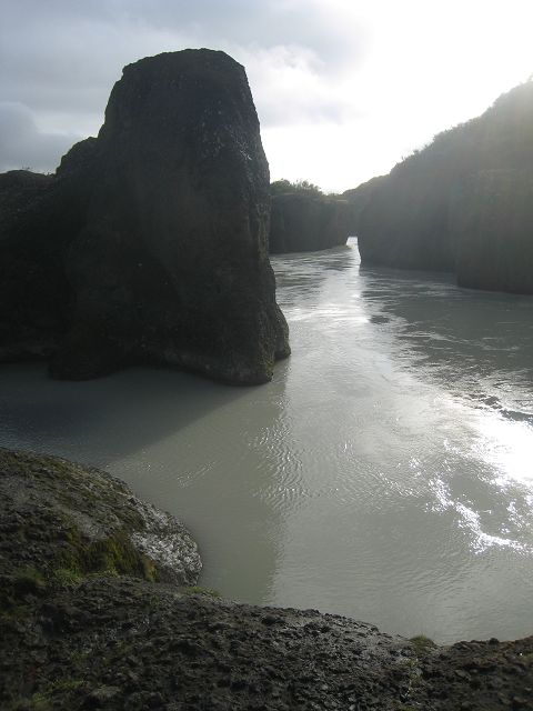
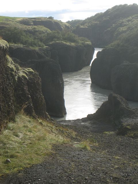
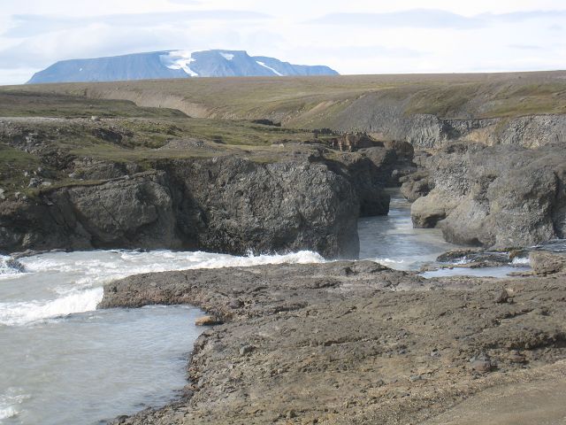
At Brúarhlöð the river Hvitá has created this nice valley.
Then I returned to Geysir, where I stayed overnight.
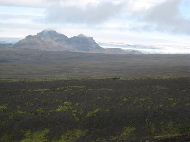
30.08.2010 Starting-km: 137.850, End-km 138.130, Distance 280 km At this Monday morning I drove up the "35", direction north-east. On my way volcanoes – what else?
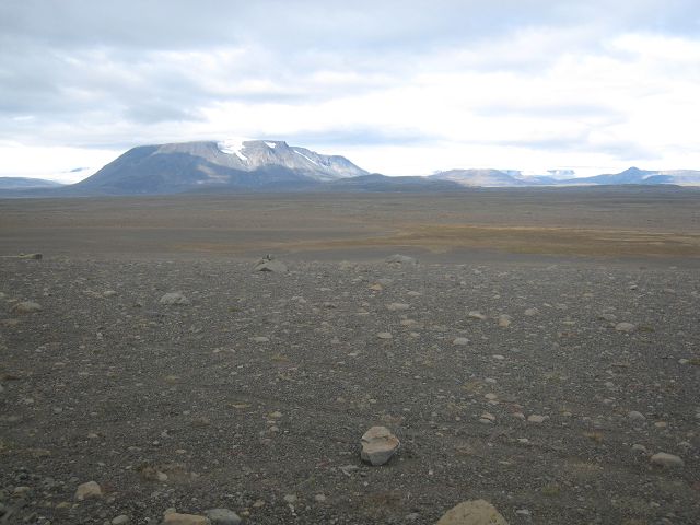
The gravel road is not too bad because it is the main one between south and north of Iceland.
My destination was Kerlingarfjöll which for sure is nice for wanderers but for me it was too cold and because it was not that often sunny I rejected that.
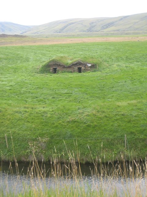
I drove back the same way and then onto the „1“ and made a stop at Keldur which belongs to the Unesco heritage because these are the oldest houses in Iceland, dating back to the 12th and 13th century.
Unfortunately not all could be visited and I wasn’t able to spot the tunnel – aged the same- which they had built for safety reasons.
After filling the tank (165l, which results in 28,2l/100km) I stopped in Hvolsvöllur at the „1“.
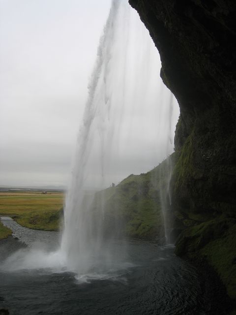
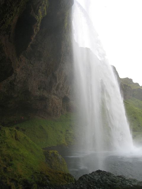
31.08.2010 Starting-km: 138.850, End-km 138.253, Distance 123 km The first bit on this Tuesday was not far, the waterfall Seljalandasfoss is more or less directly at the „1“, you just have to go the 249 for a short distance.
Because it has a height of 60 m and the possibility to walk behind it make it to something special.
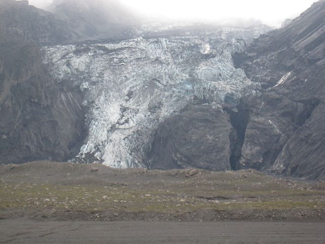
The waterfalls source is the glacier of the Eyjafjallajökull (1.666 m). This volcano has stopped 2010 the airplane traffic and I think that’s why they are building a street up to the edge of the glacier broad as a motorway – but the steepness is a different thing. When I arrived at the entry to the new road the traffic sign restricting the access was moved aside – so up I went. Because of the lots of clouds I just saw a few 100 metre - and even that only for a view minutes till the clouds in the background made even that impossible a view minutes later. (NB.: When I passed the access to the road 2 hours later again the entry was blocked.)
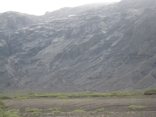
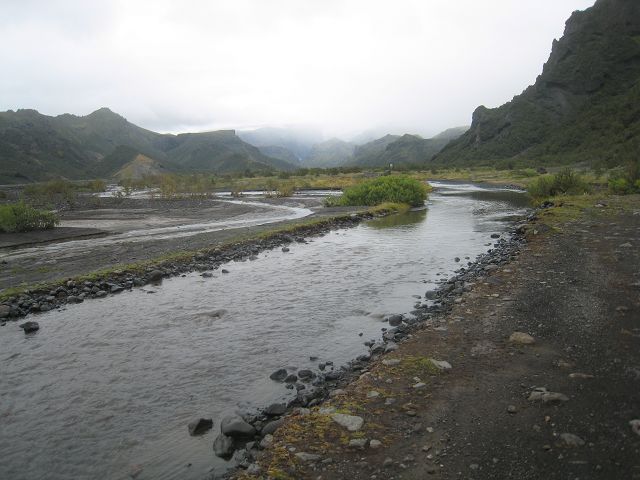
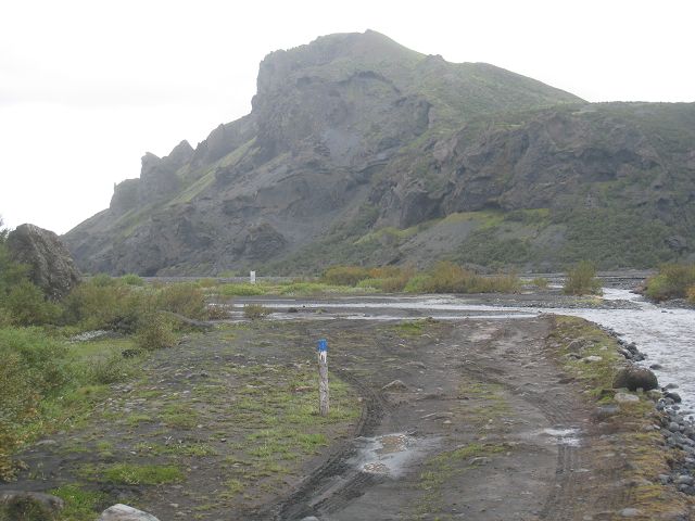
I followed the F249 along the river Krossá (Markarfljót) which was perfect in the beginning and then more and more changed into a F-Street with 3 digits.
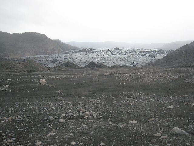
In the dust I was able to the glacier of the Eyjafjallajökull.
Just when the F249 became on the map a dotted line it was possible to get very close to the glacier.
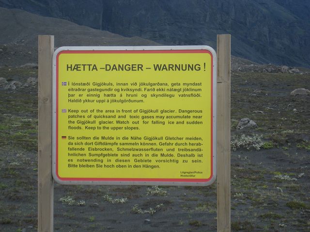
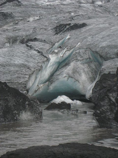
They warned about poisonous gas of the volcano.
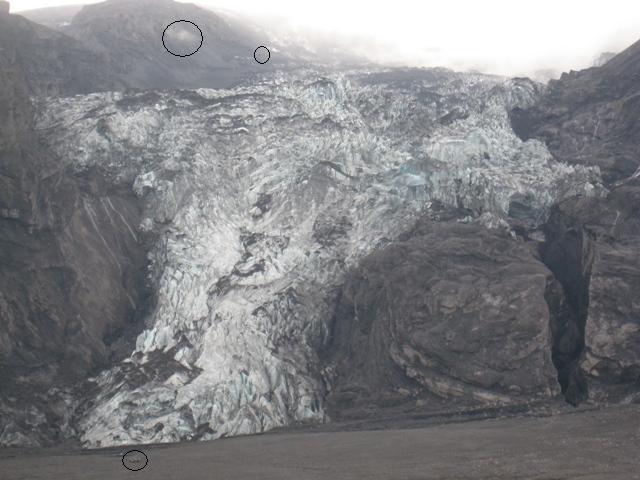
A guided group with a jeep was informed by the driver / guide that the lava had nearly reached the end of this glacier. As he told the group gas getting out can still be see (big circle on the top left). Another jeep was despite the warning directly at the end of the glacier (small circle on the bottom) and a helicopter with tourist was flying above the glacier (small circle top).
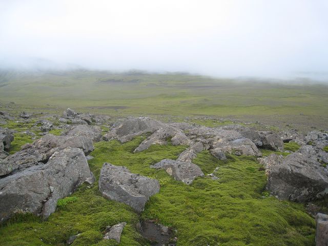
I followed the track through a beautiful area,
But some of the river crossings were not that easy because of the rocks laying on the river bed which caused cold-forming of the underride-guard on the right – I had missed to move it up! L
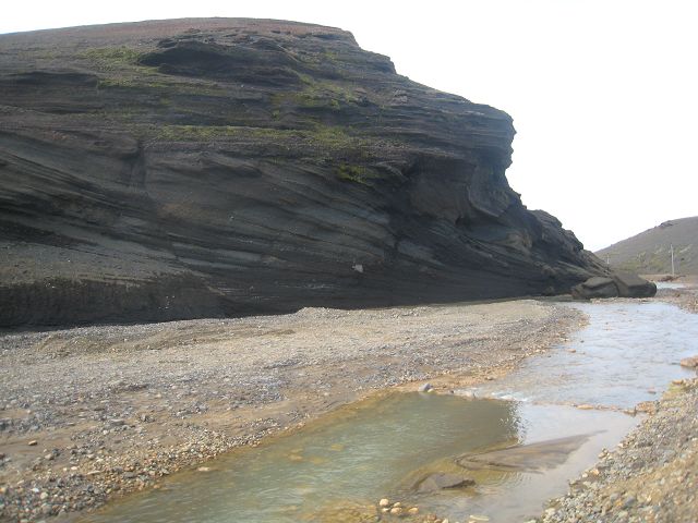
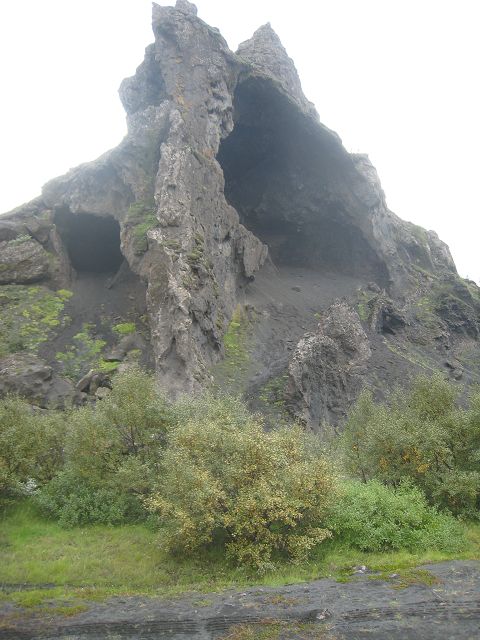
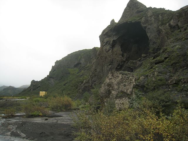
As mentioned this area called Þórsmörk before a beautiful, rough area with great rock-formations.
On the way back I drove much more careful and therefore I damaged this time only the reflector light of the underride-guard – this time of course on the left. To lift it wasn’t an option because of the tension within the construction. L
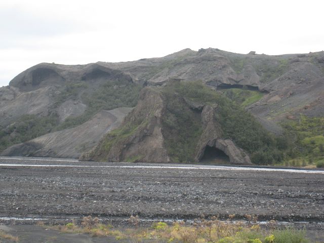
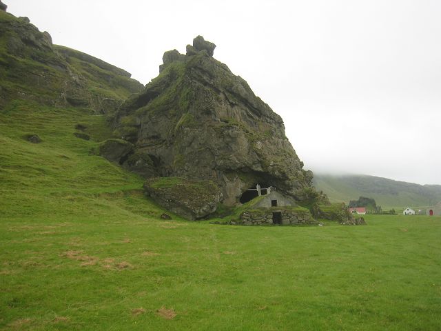
When I got back to the parking-place of Seljalandasfoss I wanted to stop for a short snack and when I entered the cabin I had to realize that the spare coffee-jug (glass) had fallen out of the board although I am 99,9% sure that I had closed the door and the push-loc. But it was only the spare one – otherwise continuing the trip would have been a really BIG problem!! J OK, after sorting out the mess and the snack I made this photo of another Big Foot. When passing by Rútshellir I made the photo of this cave with the shed in front.
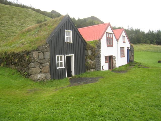
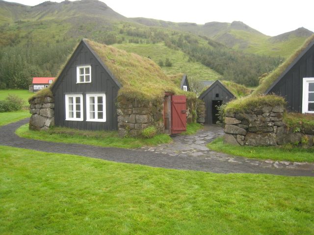
Then I drove to Skogar,
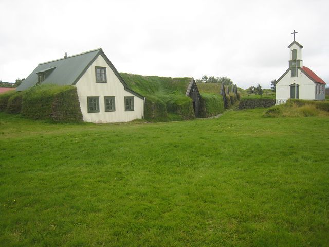
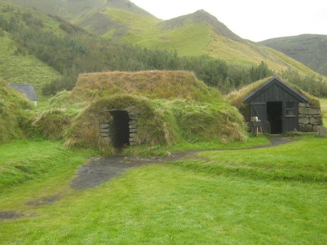
where I visited the museum, with one part for traffic and the development of Iceland, one for its culture and outside area with refurbished moss- and here re-erected houses.
Compared to most other museums I saw so far this really has a good presentation and lot to show.
Plus I was allowed to stay here overnight.
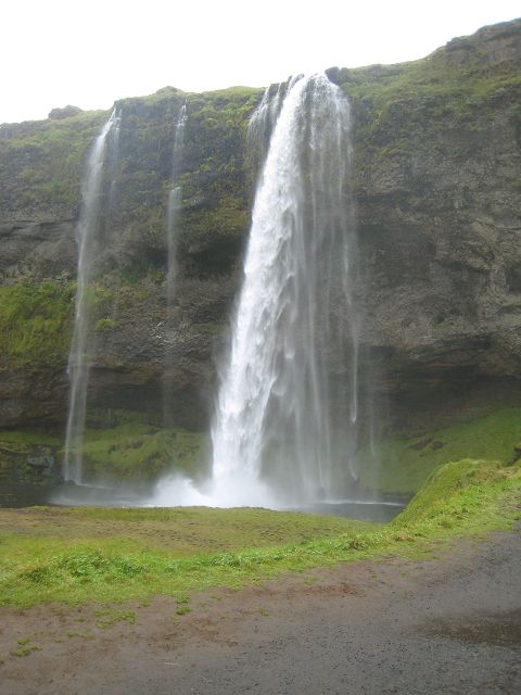
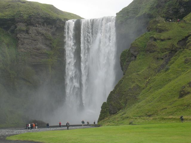
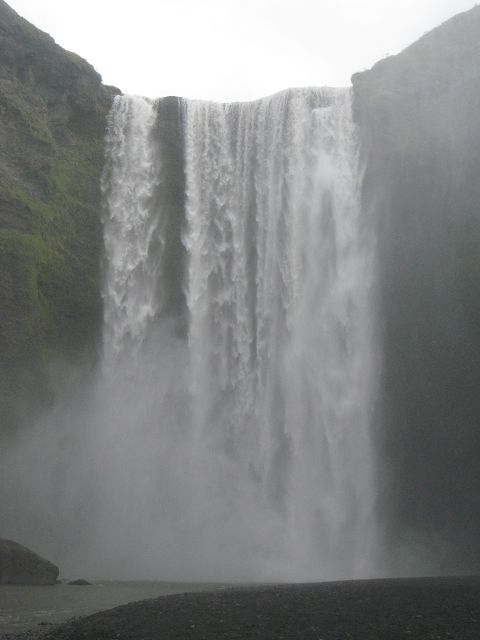
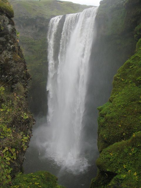
01.09.2010 Starting-km: 138.253, End-km 138.327, Distance 74 km It was just a few meters this Wednesday morning to the waterfall Skógafoss,
62 m high,
and very nice.
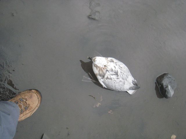
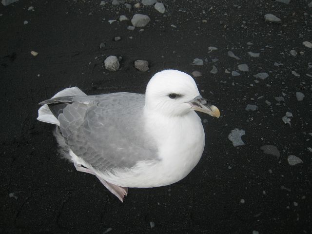
I had already asked the previous day Hans-Martin, who is working in the local museum and living here in Iceland and is a mate of Sven Strumann, what’s up with all the birds on the streets etc.. He explained to me that it is now the time where the Fulmars are leaving the nests but most of them aren’t in a condition to fly and sometimes overfed by the parents. As a result Icelanders had in this time of the year often birds as a meal! Today a lot of them are killed on the streets, which seems to be for them an ideal starting track for their attempts to fly. I got directly next to this Fulmar and due to the name of a very successful Vinten product I had to think at Bill Vinten (with all respect!), son of the founder, highly skilled engineer and engaged bird-watcher and therefore I gave this Fulmar the name “Bill” – may both have a long and good live.
Not far from here the 221 goes to the left to a part of the glacier Mýrdals-Jökull,
called Solheimajokull.
On my way back this Fulmar was blocking my way
and he was not amused that I shooed him away.
When having started to give Fulmars names I called this one Richard (again with all respect!), the ingenious engineer whilst the last years at Vinten. May both have the wind in their faces, the first when driving his motorcycle, the other when flying in the wind.
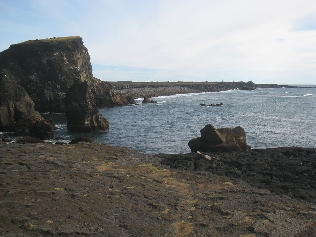
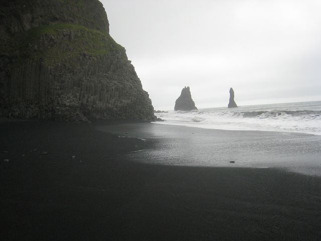
On the way to the rocks of Dyhólaey – a rough paved road goes there – I found this perfect base for my next camper van!
The rocks offer a great view,
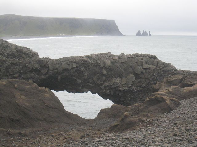
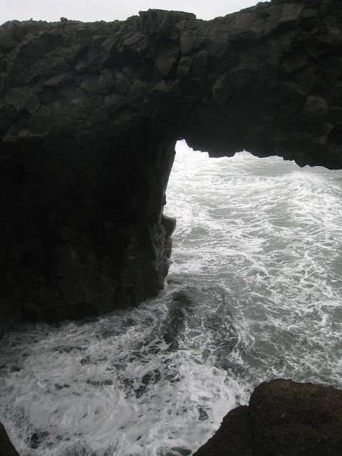
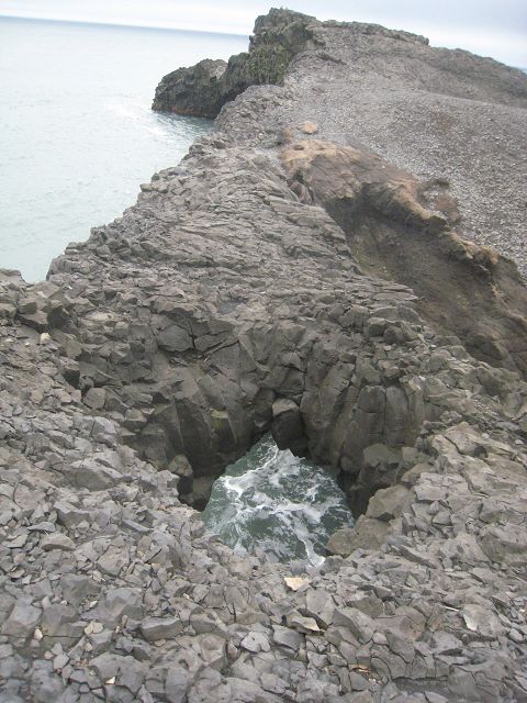
and themselves have very beautiful arches,
holes within the arches,
and from the lighthouse the big arches are visible the best.
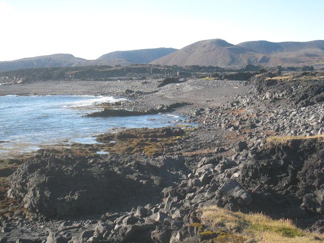
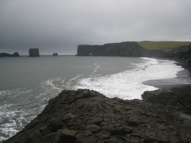
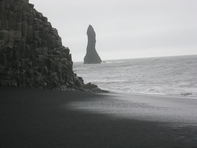
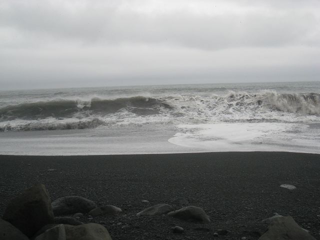
After leaving the “1” again to the 215 you will reach this beach,
where the basalt create interesting forms.
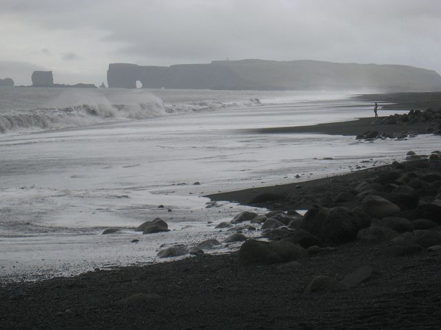
To watch the waves is great because they are getting really huge here.
I stayed here for over 4 hours and hoped that the disappearing flood will allow to move around the rock-outcrop but with falling tide the waves became even higher because of increasing wind. Behind this rock-outcrop are even more spectacular rocks and a cave.
But when even this Icelandic guy who was here already several times was nearly hit by a big wave I gave up as well the attempt to get around.
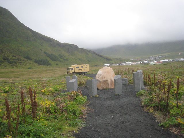
I drove to Vik, where I parked at the “German Memorial”,
but main reason for staying here overnight was not that but it offered:
|
|